/ AP
Hurricane Beryl makes landfall as Category 4
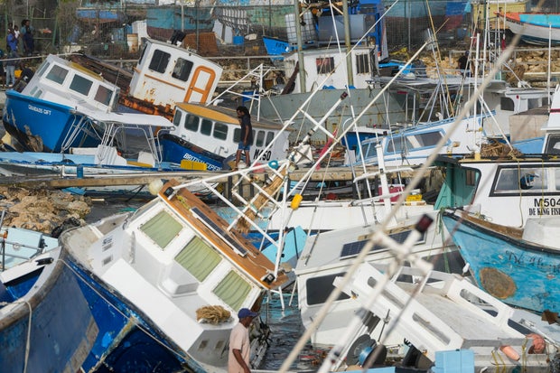
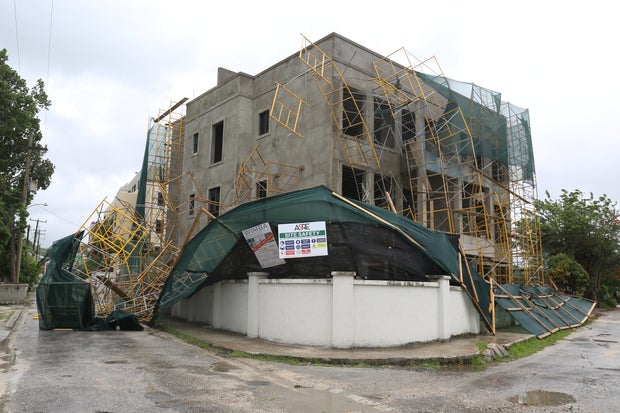
Hurricane Beryl ripped off doors, windows and roofs in homes across the southeastern Caribbean on Monday after making landfall on the island of Carriacou as the earliest storm of Category 4 strength to form in the Atlantic, fueled by record warm waters.
There were no immediate reports of possible deaths or injuries, with communications largely down across the region.
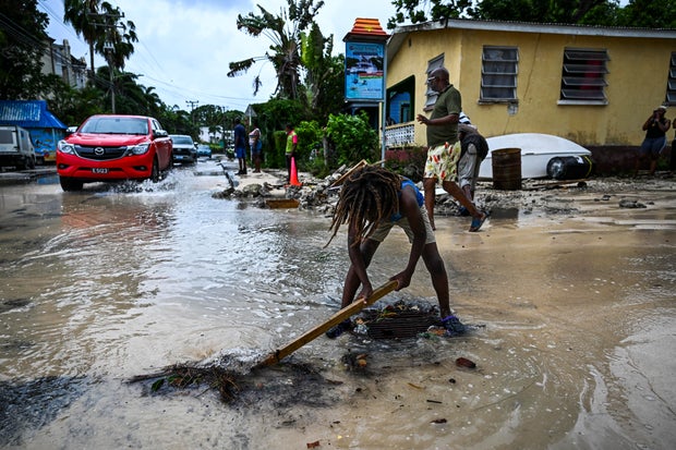
Streets from St. Lucia island south to Grenada were strewn with tree limbs, downed power lines and other debris scattered by winds up to 150 mph — just shy of a Category 5 storm. The storm snapped banana trees in half and killed cows that lay in green pastures as if they were sleeping. Homes made of tin and plywood tilted precariously nearby.
"Right now, I'm real heartbroken," said Vichelle Clark King as she surveyed her damaged shop in the Barbadian capital of Bridgetown that was filled with sand and water.
Beryl was still swiping the southeast Caribbean late Monday and was moving on a track that would take it just south of Jamaica and then toward Mexico's Yucatan peninsula by late Thursday as a Category 1 storm.

"Beryl is expected to remain an extremely dangerous major hurricane as its moves over the eastern Caribbean," the National Hurricane Center said.
The last strong hurricane to hit the southeast Caribbean was Hurricane Ivan 20 years ago, which killed dozens of people in Grenada.
NBC Radio in St. Vincent and the Grenadines said it received reports of roofs being torn off churches and schools as communications began collapsing across the southeast Caribbean.

In nearby Grenada, officials received "reports of devastation" from Carriacou and surrounding islands, said Terence Walters, Grenada's national disaster coordinator. Prime Minister Dickon Mitchell said he would travel to Carriacou as soon as it's safe, noting there's been an "extensive" storm surge.
Grenada officials had to evacuate patients to a lower floor after hospital roof was damaged, he said.
"There is the likelihood of even greater damage," he told reporters. "We have no choice but to continue to pray."

In Barbados, Wilfred Abrahams, minister of home affairs and information, said drones — which are faster than crews fanning across the island — would assess damage once Beryl passes.
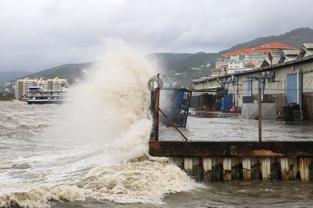
Forecasters had warned of a life-threatening storm surge of up to 9 feet (3 meters) in areas where Beryl made landfall, with 3 to 6 inches (7.6 to 15 centimeters) of rain for Barbados and nearby islands and possibly 10 inches in some areas (25 centimeters), especially in Grenada and the Grenadines.
Beryl strengthened from a tropical depression to a major hurricane in just 42 hours — a feat accomplished only six other times in Atlantic hurricane history, and with Sept. 1 as the earliest previous date, according to hurricane expert Sam Lillo.

It also was the earliest Category 4 Atlantic hurricane on record, besting Hurricane Dennis, which became a Category 4 storm on July 8, 2005.
Beryl amassed its strength from record warm waters that are hotter now than they would be at the peak of hurricane season in September, said hurricane specialist and storm surge expert Michael Lowry.
Jaswinderpal Parmar of Fresno, California, who was among the thousands who traveled to Barbados for Saturday's Twenty20 World Cup cricket final, said he and his family were now stuck there with scores of other fans, their flights canceled on Sunday.
He said by phone that it's the first time he has experienced a hurricane — he and his family have been praying, as well as taking calls from concerned friends and family as far away as India.
"We couldn't sleep last night," Parmar, 47, said.
Even as Beryl bore down on the southeast Caribbean, government officials warned about a separate cluster of thunderstorms mimicking the hurricane's path that have a 70% chance of becoming a tropical depression.
"There's always a concern when you have back-to-back storms," Lowry said. "If two storms move over the same area or nearby, the first storm weakens the infrastructure, so the secondary system doesn't need to be as strong to have serious impacts."
Beryl is the second named storm in the Atlantic hurricane season, which runs from June 1 to Nov. 30. Earlier this month, Tropical Storm Alberto made landfall in northeast Mexico and killed four people.
The National Oceanic and Atmospheric Administration predicts the 2024 hurricane season is likely to be well above average, with between 17 and 25 named storms. The forecast calls for as many as 13 hurricanes and four major hurricanes.
An average Atlantic hurricane season produces 14 named storms, seven of them hurricanes and three major hurricanes.
