By Alix Martichoux, SFGATE
Updated-
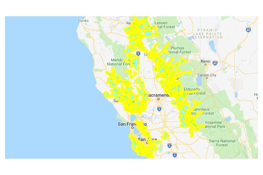
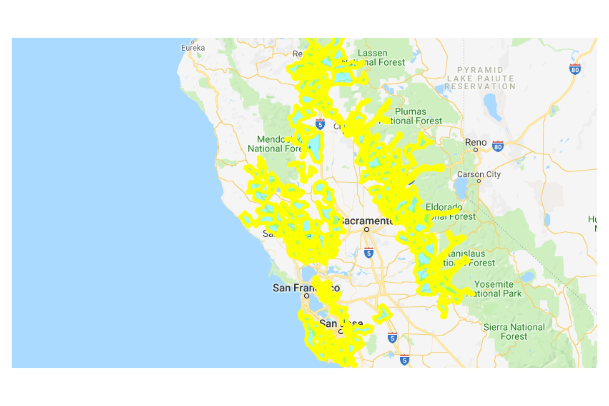
A wide view of the map shows much of Northern California will have its power shut off starting late Tuesday night. (Continue clicking or swiping through the gallery for a closer look.)
Photo: Screenshot / PG&EA wide view of the map shows much of Northern California will have its power shut off starting late Tuesday night. (Continue clicking or swiping through the gallery for a closer look.)
A wide view of the map shows much of Northern California will have its power shut off starting late Tuesday night. (Continue clicking or swiping through the gallery for a closer look.)
A wide view of the map shows much of Northern California will have its power shut off starting late Tuesday night. (Continue clicking or swiping through the gallery for a closer look.)
More than 250,000 Pacific Gas & Electric customers in the Bay Area will lose power starting Wednesday as the utility company plans to preemptively shut down power to mitigate wildfire risks.
On Tuesday afternoon, the utility announced will shut off power to 800,000 customers in Northern and Central California starting early Wednesday. PG&E said it would notify affected customers directly.
An interactive map on PG&E's website shows wide swaths of the Bay Area that will be affected by a PSPS, or public safety power shutoff. See the gallery at the top of this story for a selection of areas at risk.
Looking through the affected areas, you'll notice the hilly areas of the South Bay and East Bay are especially vulnerable.
Just because an area of the map is highlighted doesn't mean the power will definitely be shut off there. The map is also subject to change.
You can also zoom in and find your neighborhood on PG&E's interactive map on its website (though the website was intermittently down throughout the day). If the page loads, scroll down and find the second map.
The weather this week is expected to be dry and windy, which makes the risk of a catastrophic wildfire high, PG&E officials said. The utility company wants to shut off power so its electric equipment doesn't start a wildfire as has happened in recent years.
MORE: 'Inside slider' wind event forecast to bring extreme fire danger to San Francisco Bay Area
The number of potential customers affected in each Bay Area county, according to PG&E, is:
- 32,613 customers in Alameda County
- 40,219 customers in Contra Costa County
- 66,289 customers in Sonoma County
- 32,124 customers in Napa County
- 14,766 customers in San Mateo County
- 38,123 customers in Santa Clara County
- 32,862 customers in Solano County
- Marin County TBD
Marin County customers were added to the possible outage warning mid-day Tuesday, but PG&E didn't immediately report a number of customers.
As of Tuesday afternoon, San Francisco County is not expected to be affected.
Bay City News contributed to this report.
Alix Martichoux is an SFGate digital editor. Read her latest stories and send her news tips at alix.martichoux@sfgate.com.