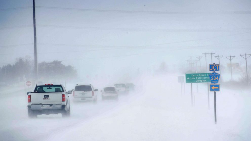
The first storm that we have been tracking that moved from the Plains to the East Coast Tuesday and Wednesday is now moving off the New England coast and will be clearing out soon.
 ABC News
Interested in Weather?
Add Weather as an interest to stay up to date on the latest Weather news, video, and analysis from ABC News.
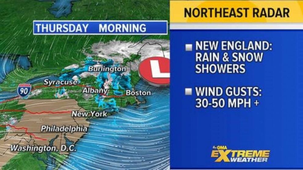
A few rain and snow showers continue to impact parts of New England from upstate New York to Maine this morning
The main issue now is the winds behind the storm -- Wind Alerts are in effect from North Carolina to New Jersey for 30 to 50 mph.
New York City is not under a Windy Advisory at the moment but winds are still quite gusty. This morning gusts have already reached near 31 mph. Later this morning gusts could reach 35 to 40 mph during Macy’s Thanksgiving Day Parade so we will have to see what they decide to do about the floats.
 ABC News
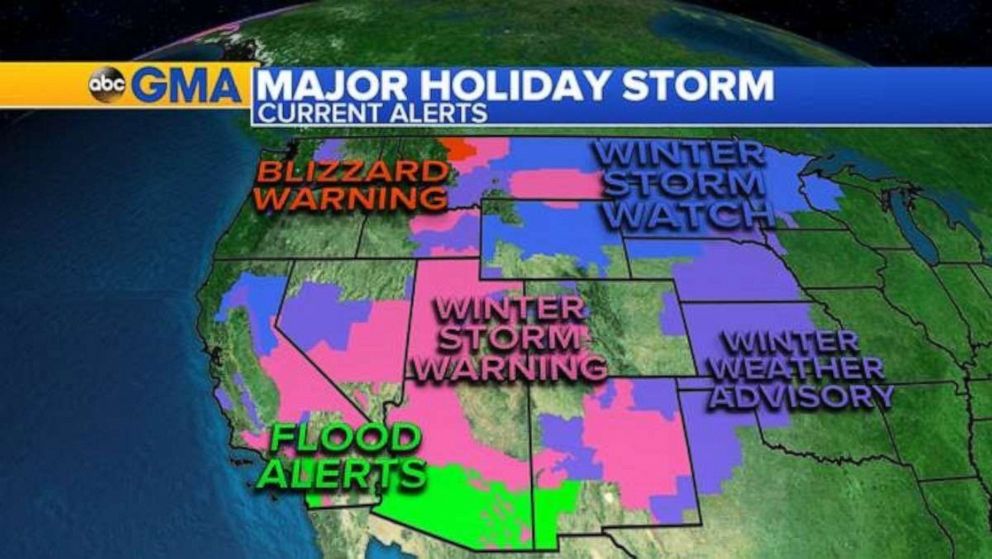
Twenty states from California to Michigan are under alert as the major storm out West continues to bring heavy mountain snow, blizzard conditions ice, flooding rain, and gusty winds across the region.
Parts of California, Arizona, and new Mexico are under Flash Flood Watch as rounds of heavy rain are expected to continue there today through Friday. Flash flooding and debris flow is possible during the heaviest downpours.
Winter Storm Warnings are in effect from the Sierras to the Central and Southern Rockies where heavy mountain snow is forecast Thursday to Friday, locally 2 to possibly more than 4 feet of snow in the highest elevations.
 ABC News
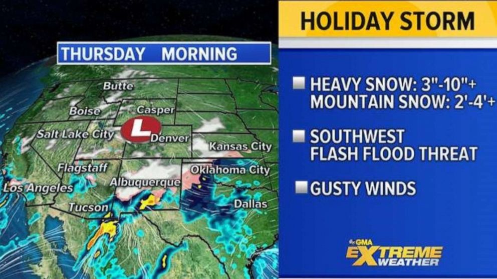
As this storm moves east into the Plains by the weekend, Winter Storm Watches are in effect from Montana to Michigan with blizzard conditions possible. Some spots could see a foot of snow and strong winds. As of this morning we are watching unsettled weather moving across parts of the Southwest and Southern Plains from California to Kansas
In the Los Angeles area, a few daily rainfall records were broken and more rain is on the way today. With heavy snow hitting Albuquerque today, they will likely have their snowiest Thanksgiving on record. Texas, the Oklahoma panhandle and parts of Kansas are also getting in on some snow and ice action this morning with 1 to 3 inches of snow possible with freezing rain which could make for dangerous travel getting to Grandma’s for Thanksgiving this morning.
The flash flood threat will continue through Friday, especially across southern Arizona and New Mexico with more rounds of heavy rain moving through the region. Douglas Airport near Tucson, Arizona has already had 3.6 inches of rain so far this month making it the rainiest November on record and more rain is on the way before the month closes out.
Very heavy mountain snow will continue later today through Friday from the Sierra mountains across Utah, northern Arizona and Minnesota and into Colorado and Wyoming with several more feet of snow and whiteout conditions on the way.
 ABC News
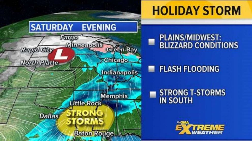
By Saturday, the major Western storm is moving into the Central U.S. stretching from the Northern Plains to the Gulf Coast with heavy snow, heavy rain and severe weather.
Blizzard conditions and a foot of snow is possible for parts of the Northern Plains and Upper Midwest. Severe weather with damaging winds and isolated tornadoes are possible across Texas, Louisiana and Mississippi.
 ABC News
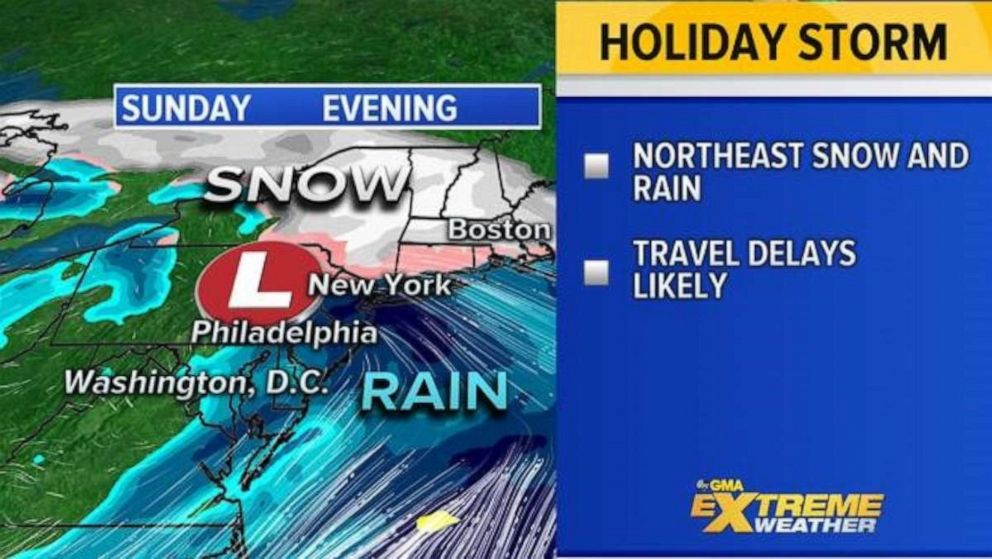
By Sunday, the major storm continues to move across the country and reaches the Northeast with a mix of rain and snow. Widespread travel delays are possible as people try to get home from the Thanksgiving holiday.
 ABC News
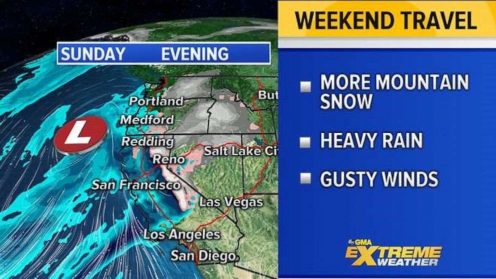
While the East Coast now deals with that major cross country storm on Sunday, the West Coast will likely be seeing yet a new round of unsettled weather to impact holiday travel for them on Sunday too.
